Google Earth

500M+
Installs
Google LLC
Developer
-
Travel & Local
Category
-
Everyone
Content Rating
-
apps-help@google.com
Developer Email
-
http://www.google.com/policies/privacy
Privacy Policy
Screenshots
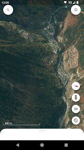
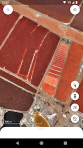
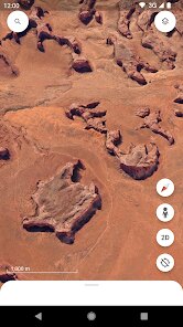
editor reviews
Google Earth, developed by Google LLC, is a geospatial application that lets you explore the entire planet from your screen. It's not just a map; it's a 3D interactive globe that lets you zoom into streets, fly over mountains, and even check out the stars from space. The app has been around since 2001, initially as a desktop program, but it eventually made its way to mobile. You can pick it up for free on the Google Play store, and it's also available on Apple's App Store. Since it's free to download and install, there's no registration required to start exploring, though you can sign in with your Google account to save your favorite places. The app does include some in-app purchases for things like the “Voyager” premium layer content, but the core features are completely free. It's also ad-supported, so you'll see a few sponsored points of interest as you move around. The install count on Google Play alone is over a billion, which speaks to its massive user base, and the ratings sit around 4.5 stars from millions of users. Honestly, when I first downloaded it, I was just killing time, but it quickly turned into a way to plan trips, show my kids what other countries look like, and even satisfy my curiosity about remote places. It's for anyone—students working on geography projects, travelers checking out terrain before a hike, or just curious folks who want to see what's at the end of a random street in Tokyo. You don't need any special skills to use it; you just need a device and a little patience.
Using Google Earth is pretty straightforward. Once you install it from Google Play, you can either tap the search bar to type in a location or pinch to zoom out and manually swim around the globe. A neat tip is to use the “I'm Feeling Lucky” button, which drops you into a random fascinating place—it's a fun way to discover things you never knew existed. For navigation, you can swipe with two fingers to tilt the view, which gives you that “flying” feeling. When you find a spot you like, tap the plus button to add a placemark or draw lines to measure distances. The “Voyager” section is a hidden gem—it's full of guided tours created by scientists and artists, like exploring the Great Barrier Reef or tracking the migration of wildebeests. If you're on a phone, I'd suggest downloading map areas for offline use, because that works for the basic 2D view, even though 3D needs a connection. Also, keep in mind that the app can be a bit heavy on battery and data, so it's wise to close it when you're done, especially if you're on a limited plan.
Compared to other mapping apps like Google Maps or the more basic Maps app from Apple, Google Earth is a different beast. Google Maps is my everyday navigator for driving directions and traffic, but it doesn't have that immersive 3D world feel. I remember trying Apple Maps for street views, but it just didn't have the same global coverage. What made me stick with Google Earth is the depth—I can see the Colosseum in Rome with 3D models that let me virtually walk around it, or look at the Grand Canyon from above with such detail that I feel like I'm flying. Other apps like NASA's Worldview are more scientific, but they lack the user-friendly interface. Honestly, for a casual user like me, Google Earth is the winner because it balances fun with functionality, and it doesn't overwhelm you with ads or clutter. I've deleted and reinstalled it a few times over the years, but I always come back to it.
features
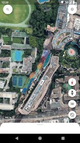
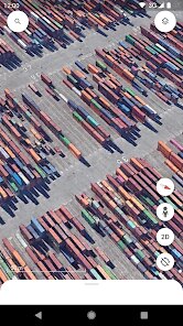
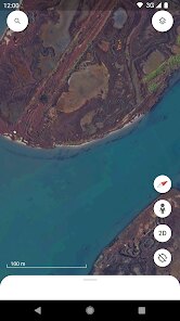
- 🌍 The standout feature is the 3D terrain and buildings. Unlike Google Maps, which shows flat streets, Google Earth lets you tilt the camera to see real elevation changes. I can zoom into a canyon and see actual cliffs, or fly over my city and recognize specific landmarks because the buildings are modeled in 3D. It's like a video game but based on reality.
- 🛰️ The “Voyager” section is a game-changer. It's not in the standard Google Maps app—you need the Earth app to get this. Voyager offers interactive stories from organizations like National Geographic and NASA. I spent an afternoon following a tour of ancient Roman ruins, and it felt like a guided museum exhibit, with photos and text popping up as I moved along.
- 🔍 The search function is next-level. You can type in a general description like “beaches in Australia” and it will show you geographically relevant spots, whereas Google Maps usually only finds specific addresses. I also love that you can search for “factories” or “forests” and see how land use is distributed across regions, which is impossible with other map apps.
- 📸 The historical imagery feature is something I didn't expect. You can slide a timeline bar to see how an area looked years back, using satellite photos from the past two decades. I compared my neighborhood now versus in 2005, and it was fascinating to watch housing developments pop up. Google Maps doesn't offer this, so it's a huge plus for me.
pros
- ⚡ It's completely free with no hidden paywalls for basic use. Apple Maps and Google Maps are also free, but they don't give you the same level of 3D detail without extra tools. I've never felt pressured to buy anything to get value out of Google Earth.
- 🌐 The offline caching for 2D view is a lifesaver. When I'm out hiking without service, I can still pull up cached maps, unlike with some map apps that require a constant connection. This makes it reliable for outdoor trips, which is better than my experience with HERE WeGo.
- 👨👩👧 It's educational without being boring. My kids use it for school projects, and they actually enjoy exploring rather than just reading text. Compared to apps like National Geographic's standalone guides, Google Earth covers more ground and is more interactive, so it's a one-stop shop for learning.
cons
- 🐢 The performance can be sluggish on older phones. I have a mid-range Android, and zooming into heavy 3D areas causes lag. Google Maps runs smoother on the same device, which is annoying when I'm trying to quickly check a location.
- 📶 It eats up data like crazy. Streaming 3D tiles over mobile data drained my 2GB plan in a week. Other light map apps like Maps.me are much more data-efficient, so I have to remember to use Wi-Fi only.
- ❌ No live traffic or transit info. If I need real-time driving conditions or bus schedules, I have to switch to Google Maps. Having two apps installed is a hassle, and I wish Google integrated traffic lights into Earth just for convenience.
Recommended Apps
![]()
Google One
Google LLC4.1
![]()
Glam AI: Video & Photo Editor
Glam Labs, Inc.4.6
![]()
Pencil Sketch
Dumpling Sandwich Software Inc.4.7![]()
Monster Girl Maker 2
GHOULKISS4.3![]()
Wonder - AI Art Generator
Codeway Dijital3.7![]()
Prediction 2026: Savage Reveal
LKPixel0![]()
AI Photo Editor, Collage-Fotor
AI Art Photo Editor | Everimaging Ltd.4.3![]()
PixVerse: AI Video Generator
PixVerse4.5![]()
Photo Collage Editor
MeiHillMan4.7![]()
Google Maps
Google LLC4.2![]()
Walgreens
Walgreen Co.4.7![]()
QR Code Reader Barcode Scanner
Celebrity App Studio3.9![]()
Serene - Zodiac Compatibility
Hashtag inovation2.8![]()
Venmo
PayPal, Inc.4.2![]()
BESTPLAY Play to earn & donate
Bestplay4.7